What We Do
 The Justice Mapping Center is supported by a mix of foundation grants and fees for service. Some of the services we provide are listed below. Look through our Project Gallery to view a few of our mapping studies:
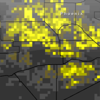
- Mapping studies of criminal justice population concentrations, including adults and juveniles going in and out of prison and jail; people on probation and parole; and, juveniles in detention.
- Graphics and other charts of administrative, political, social, educational, and other boundary aggregations, such as school districts, city council jurisdictions, neighborhoods, or police precincts.
- Supportive contextual maps of socio-demographics, such as single parent households, disconnected youth, home ownership rates, poverty, income, and many other census bureau statistics.
- Maps of other government health and human services, child welfare, and labor populations, such as TANF, Food Stamps, Medicaid, and Unemployment Insurance recipients, as well as Foster Care clients and reports of Abuse and Neglect.
- Mapping studies of prison and jail expenditures.
- Spider mapping analyses of probation and parole caseload distributions.
- Maps of geographic and neighborhood overlaps between criminal justice and other government client populations.
- Prisoner reentry mapping studies.
- Maps of community institutional networks, such as the location, capacity, and performance of schools, or government institutional networks, such as federally qualified health centers.
In some cases we provide standardized analyses, such as those listed above. In other cases, we work with our partners to forge new visualizations of their data to fit the specific purposes of their initiatives.  Therefore, our studies are used both as stand-alone reports and as new spatial analyses and visual designs to augment existing research and reports. One thing our maps do not do is expose individual information about the populations under study. Although much of our data consists of individual address information, our maps do not portray those specific addresses; instead we aggregate data to the census block, block-group, tract, neighborhood or higher geographical levels. That way our studies are sufficiently precise to focus attention on neighborhoods and other small areas most affected by criminal justice and other social and economic policies without being unnecessarily invasive as to breach confidentiality issues.